Afaylu:Claudius Ptolemy- The World.jpg

Aksay n uẓṛi ad :800×576 piksil Tibuda yaḍnin:320×230 piksil | 640×461 piksil | 1 024×737 piksil | 1 280×922 piksil | 2 560×1 843 piksil | 8 073×5 813 piksil
Afaylu anṣli (8 073 × 5 813 piksil, tiddi n ufaylu: 18,03 Mio, anaw MIME: image/jpeg)
| Artiste |
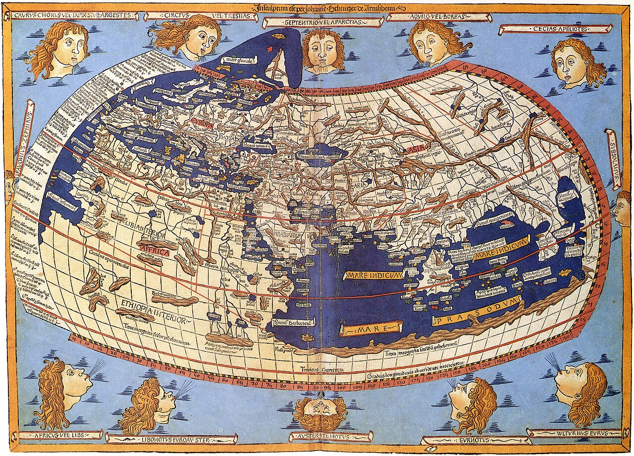
Lord Nicolas the German (Donnus Nicholas Germanus), cartographer Johann the Blockcutter of Armsheim (Johannes Schnitzer or Johannes de Armssheim), engraver |
||||
| Amgay | |||||
| Aglam |
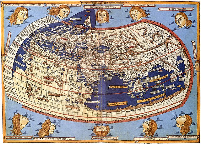
English: The world map from Leinhart Holle's 1482 edition of Nicolaus Germanus's emendations to Jacobus Angelus's 1406 Latin translation of Maximus Planudes's late-13th century rediscovered Greek manuscripts of Ptolemy's 2nd-century Geography. |
||||
| Asakud | 1482 | ||||
| Source / photographe | Decorative Maps by Roderick Barron - ISBN 1851702989 | ||||
| Turagt (Ssmrs daɣ afaylu ad) |
|
||||
| Autres versions |
|
||||


Amzruy n ufaylu
Adr i usakud/akud ad tẓrt afaylu mk lli tt inn ikka ɣ tizi ann.
| Asakud/Akud | Tawlaft mẓẓin | Imnadn | Asmras | Axfawal | |
|---|---|---|---|---|---|
| amiran | 31 Kṭubr 2023 à 09:26 | | 8 073 × 5 813 (18,03 Mio) | OnlySlightlyDamp | Reverted to version as of 03:58, 3 July 2007 (UTC) |
| 22 Kṭubr 2023 à 09:08 |  | 8 226 × 5 919 (19,53 Mio) | Shekishekiey | Reverted to version as of 03:54, 3 July 2007 (UTC) | |
| 3 Yulyu 2007 à 04:58 |  | 8 073 × 5 813 (18,03 Mio) | SCEhardt | cropped & rotated | |
| 3 Yulyu 2007 à 04:54 |  | 8 226 × 5 919 (19,53 Mio) | SCEhardt | {{Information |Description=Claudius Ptolemy: The World |Source=Scanned by Scott Ehardt from Decorative Maps by Roderick Barron - ISBN 1851702989 |Date=1482 |Author=Johannes Schnitzer, engraver<br>Claudius Ptolemy, cartographer |Permissio |
Asmrs n ufaylu
tasna ad iḍfarn gis afaylu ad:
Aswuri aɣzuran n ufaylu
Id wiki ad ar swurin s ufaylu ad:
- Asmrs ɣ af.wikipedia.org
- Asmrs ɣ ar.wikipedia.org
- Asmrs ɣ az.wikipedia.org
- Asmrs ɣ be.wikipedia.org
- Asmrs ɣ bg.wikipedia.org
- Asmrs ɣ bh.wikipedia.org
- Asmrs ɣ bn.wikipedia.org
- Asmrs ɣ br.wikipedia.org
- Asmrs ɣ ca.wikipedia.org
- Asmrs ɣ de.wikipedia.org
- Asmrs ɣ el.wikipedia.org
- Asmrs ɣ en.wikipedia.org
- Asmrs ɣ eo.wikipedia.org
- Asmrs ɣ es.wikipedia.org
- Asmrs ɣ eu.wikipedia.org
- Asmrs ɣ fa.wikipedia.org
- Asmrs ɣ fr.wikipedia.org
- Asmrs ɣ fr.wikiversity.org
- Asmrs ɣ fy.wikipedia.org
- Asmrs ɣ ga.wikipedia.org
- Asmrs ɣ hi.wikipedia.org
- Asmrs ɣ hu.wikipedia.org
- Asmrs ɣ hy.wikipedia.org
- Asmrs ɣ id.wikipedia.org
Ẓruggar f ussmrs amatay n ufaylu ad.