Afaylu:EU-Poland.svg

Taille de cet aperçu PNG pour ce fichier SVG : 713×600 piksil. Tibuda yaḍnin:285×240 piksil | 571×480 piksil | 913×768 piksil | 1 218×1 024 piksil | 2 435×2 048 piksil | 2 045×1 720 piksil
Afaylu anṣli (Afaylu SVG, tabadut n 2 045 × 1 720 id piksil, tiddi n ufaylu: 7,33 Mio)
польша
Azgzl
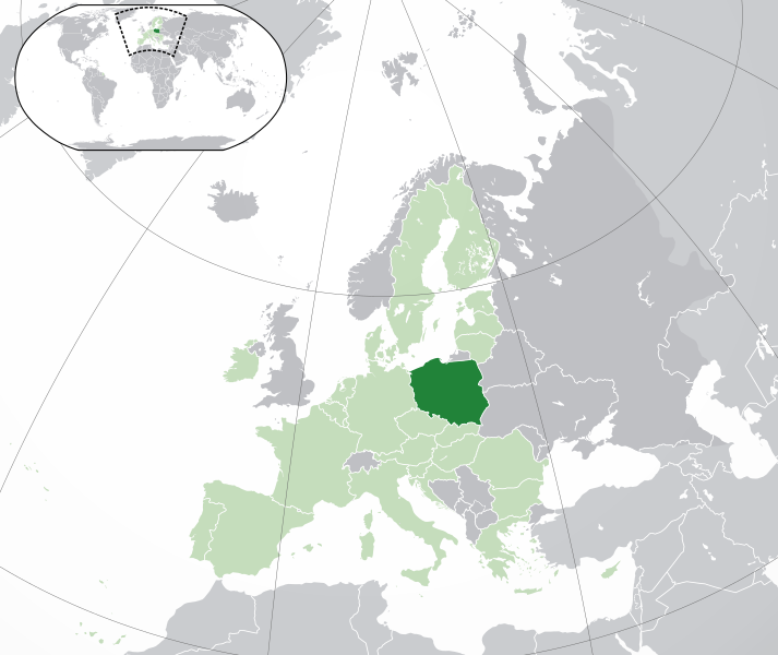
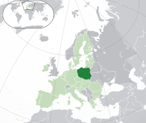
Polski:
(Green) Polska.
(Light-green) Unia Europejska (UE).
(Gray) Europa.
(Light-gray) Inne terytoria.
| Aglam |
English: (Dark-Green) Poland. (Light-Green) The rest of the European Union (EU). (Dark-gray) The rest of Europe. (Light-gray) The surrounding region.
See also: |
| SVG information | Le code de ce grand fichier SVG n'est pas valide en raison de 12 erreurs. |
| Asakud | |
| Asagm | Travail personnel basé sur : Location European nation states.svg |
| Amgay | NuclearVacuum |
| Autres versions |
|
| SVG information | Le code de ce grand fichier SVG n'est pas valide en raison de 12 erreurs. |


Taragt
Moi, en tant que détenteur des droits d’auteur sur cette œuvre, je la publie sous les licences suivantes :
Afaylu ad illa ddu tfadiwin n turagt Creative Commons Attribution-Share Alike 3.0 Unported.
- Tgit win ixf nnk/nnm:
- fsr – afad ad tnɣlt, ad tzuzrt nɣ ad tbḍut tawuri ad
- sgiddi – sgiddi tawuri
- Ddu tfadiwin ad:
- Tibbabwt – Iqqan d ad tbdrm ism n umskar anṣli tbdrm ula asɣun immaln amskar n umahil nɣ bab n izrfan, tbdrm iɣ ittwasnfl zgis kra nɣ d uhu. Tzḍarm ad tskrm mk ad s mk da tram, maccan s kra n tɣarast immaln ma s d imsacka bab n twuri.
- fsr ikniwn – Iɣ tsnflm nɣ tsmattim nɣ tẓkim f twuri ad, illa fllawn ad tbḍum tumutin nnun ddu turaqt ann nit nɣ kra n turagt d yuckan d tdslant.

|
Dark turagt n ad tssnɣlt, ad tbḍut d ad tsnflt tantamt ad ddu tfadiwin n turagt jinu i tntamin tilelliyin tunɣilt 1.2 nɣ tunɣilt tamaynut akk nna tẓrg tamrslt n isuftwurn ilelliyn, min tizuniwin armskiln, min aḍris n tasna tamzwarut n tduli d min aḍris n tasna tamggarut n tduli.Yat tunɣilt n turagt tkcm ɣ tzuni ilan azwl GNU Free Documentation License. |
Tɣit ad tstit turagt nna trit.
Amzruy n ufaylu
Adr i usakud/akud ad tẓrt afaylu mk lli tt inn ikka ɣ tizi ann.
| Asakud/Akud | Tawlaft mẓẓin | Imnadn | Asmras | Axfawal | |
|---|---|---|---|---|---|
| amiran | 1 Bṛayṛ 2020 à 06:19 | | 2 045 × 1 720 (7,33 Mio) | Rob984 | UK and Gibraltar have left the EU. New base which includes all of Portugal's islands within frame, as well as Arctic Russian islands part of Europe. Also fixed Flevoland in the Netherlands. |
| 25 Kṭubr 2016 à 21:34 |  | 2 045 × 1 720 (7,32 Mio) | Giorgi Balakhadze | fix | |
| 24 Dujanbir 2015 à 10:25 |  | 2 045 × 1 720 (7,33 Mio) | Nordwestern | Per original framework and Commons' rules. Agree with A2D2. | |
| 18 Mars 2015 à 16:58 |  | 2 045 × 1 720 (7,38 Mio) | Mapclean | Reverted to Leftcry's version, please go to your talk page | |
| 21 Bṛayṛ 2015 à 15:10 |  | 2 045 × 1 720 (2,61 Mio) | VS6507 | Spain. Greece. Slovakia. Cyprus. Romania VETO | |
| 16 Nuwanbir 2014 à 20:34 |  | 2 045 × 1 720 (7,38 Mio) | Leftcry | Reverted to version as of 15:48, 6 August 2014 Please go to your talk page | |
| 16 Nuwanbir 2014 à 17:36 |  | 2 045 × 1 720 (2,61 Mio) | A2D2 | The map must show the original de-jure status with no breakaway regions, as it was originally created. An alternative map showing the de-facto status with breakaway regions needs to be created instead. | |
| 6 Ɣuct 2014 à 16:48 |  | 2 045 × 1 720 (7,38 Mio) | Rob984 | Improved version: More accurate coastline, borders, etc. Added Gradient and Longitude and latitude lines. Sudan border. | |
| 1 Yulyu 2013 à 10:31 |  | 2 045 × 1 720 (2,61 Mio) | U5K0 | croatia | |
| 23 Kṭubr 2009 à 15:41 |  | 2 045 × 1 720 (2,59 Mio) | NuclearVacuum | consensus version |
Asmrs n ufaylu
tasna ad iḍfarn gis afaylu ad:
Aswuri aɣzuran n ufaylu
Id wiki ad ar swurin s ufaylu ad:
- Asmrs ɣ ace.wikipedia.org
- Asmrs ɣ ady.wikipedia.org
- Asmrs ɣ af.wikipedia.org
- Asmrs ɣ ami.wikipedia.org
- Asmrs ɣ ar.wikipedia.org
- العلاقات البولندية السعودية
- مستخدم:ElWaliElAlaoui/ملعب 8
- معاملة المثليين في بولندا
- مستخدم:جار الله/قائمة صور مقالات العلاقات الثنائية
- العلاقات الأمريكية البولندية
- العلاقات الأنغولية البولندية
- العلاقات البولندية الكورية الجنوبية
- العلاقات الإريترية البولندية
- العلاقات البولندية السويسرية
- العلاقات البولندية الليختنشتانية
- العلاقات البولندية البوليفية
- العلاقات البولندية الموزمبيقية
- العلاقات الألبانية البولندية
- العلاقات البلجيكية البولندية
- العلاقات الإثيوبية البولندية
- العلاقات البولندية البيلاروسية
- العلاقات البولندية الطاجيكستانية
- العلاقات البولندية الروسية
- العلاقات الأرجنتينية البولندية
- العلاقات البولندية الغامبية
- العلاقات البولندية القبرصية
- العلاقات البولندية السيراليونية
- العلاقات البولندية النيبالية
- العلاقات البولندية الليبيرية
- العلاقات التشيكية البولندية
- العلاقات البولندية الميانمارية
- العلاقات البولندية الكندية
- العلاقات البولندية الزيمبابوية
- العلاقات الإسرائيلية البولندية
- العلاقات البالاوية البولندية
- العلاقات البولندية المالية
- العلاقات البولندية النيجيرية
- العلاقات اليمنية البولندية
- العلاقات البولندية الفانواتية
- العلاقات الغابونية البولندية
- العلاقات البنمية البولندية
- العلاقات البولندية الكوبية
- العلاقات البولندية الجورجية
- العلاقات البولندية التونسية
- العلاقات البولندية الكورية الشمالية
- العلاقات الهندية البولندية
- العلاقات اليابانية البولندية
- العلاقات الإيطالية البولندية
- العلاقات البولندية الناوروية
- العلاقات الأسترالية البولندية
- العلاقات البولندية الزامبية
Ẓruggar f ussmrs amatay n ufaylu ad.